
Satellite Images Reveal Massive Forest Loss in Sheringal, KPK
New satellite imagery has revealed alarming levels of deforestation in the Sheringal area of Khyber Pakhtunkhwa, raising fresh concerns among environmental experts and local residents about illegal logging and the rapid destruction of forest cover in the region.
5/17/20261 min read
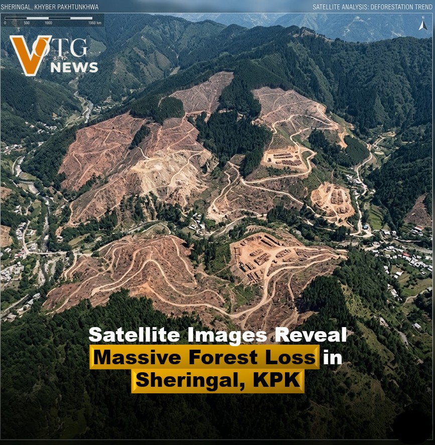

The images, reportedly comparing recent land conditions with previous years, show significant loss of dense forest areas across mountainous terrain once known for its rich greenery and biodiversity. Environmental observers warn that unchecked tree cutting could have long-term consequences for the ecosystem, local climate, and water resources.
Sheringal, located in Upper Dir, is home to important forest reserves that play a vital role in preventing soil erosion, supporting wildlife habitats, and maintaining ecological balance. Experts say continued deforestation increases the risk of floods, landslides, and environmental degradation, especially during heavy rainfall seasons.
Local communities and environmental activists have called on authorities to launch an immediate investigation into the causes behind the large-scale forest loss. Many are demanding stricter monitoring, stronger enforcement against illegal timber activities, and urgent reforestation efforts to protect the remaining green areas.
Officials have yet to release a detailed statement regarding the satellite findings, but the growing concern has once again highlighted the need for stronger environmental protection policies in Pakistan’s northern regions.
The latest revelations serve as a reminder of the increasing environmental challenges facing the country, where climate change and deforestation continue to threaten natural ecosystems and local livelihoods.
Disclaimer: This update is shared based on publicly available information. VOTG News is not responsible for any decisions made based on this news. The image is AI-generated only for illustration